
The Brooklyn-Queens Connector’s Greatest Risk Is Leaving Money on the Table
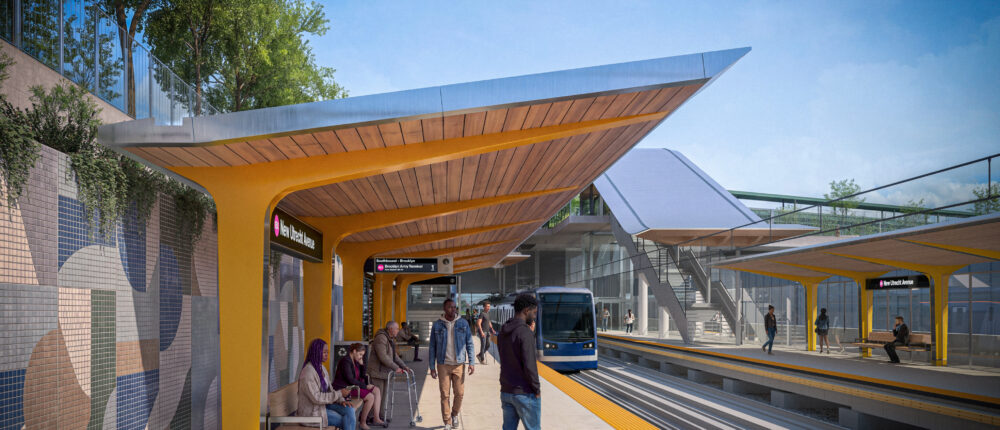
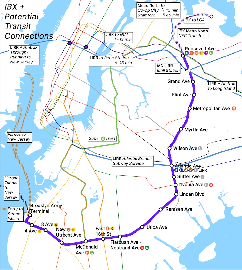
On a map, the Interborough Express looks almost too easy. Take an existing freight right-of-way that arcs 14 miles from Sunset Park to Jackson Heights. Put passenger trains on it. Connect Brooklyn and Queens without forcing riders through Manhattan. The MTA projects about 160,000 daily riders and a 32-minute ride from one end to the other, a trip that today involves a long detour through Manhattan.
Roughly a million people live within half-mile of the corridor. Seven in 10 are people of color, and one in five lives below the poverty line. At Remsen Avenue in East Flatbush, the number of jobs reachable within 30 minutes would jump from about 140,000 to nearly 1 million. The number of colleges within reach would go from two to almost 20. This is how economic development has a material impact on people’s lives: by making a job interview, a night class, or a degree program something reachable instead of another stress test.
At a recent briefing organized by the Urban Design Forum on how to plan and deliver the IBX, the people closest to the project were candid about how much harder it is than the map suggests. They were also clear that the line will create enormous economic value along its route. The open question is whether the city will move fast enough, and in a coordinated enough way, to put that value to work.
Why This Is Hard
In practice, at most of the IBX stations, a “connection” to the subway will mean leaving one station, walking along the street, and entering another station. That is the price of following a freight line. The right-of-way is more than a century old and narrows considerably in places. Freight has to keep moving through years of construction, past roughly 90 bridges and other structures.
At the southern terminus, the MTA plans to put the IBX rail yard, maintenance shops, and control center on the Brooklyn Army Terminal campus. But the campus is already crowded with a Port Authority freight yard that is federally required to keep running, city roadway operations that cannot shut down, and a 30-foot-wide sewer that nothing can be built on top of. The MTA has to fit its facilities around all of them, and every unresolved agreement is a potential construction delay.
Then there is money and control. The MTA’s 2025–2029 capital plan sets aside $2.75 billion, about half of the MTA’s 2023 cost estimate of $5.5 billion, and assumes substantial federal money for the rest. That money is far from certain. North of Metropolitan Avenue, the line runs on CSX’s Fremont Secondary, where the MTA has no operating rights and is still negotiating. In Middle Village, a tunnel under All Faiths Cemetery proved too narrow for freight and passenger trains, so the MTA committed to building a new one.
All of this takes time, and time is money. This is why the land-use side of the IBX matters so much. Done well, it can help pay for the line. Done slowly, costs go up.
The Value at Stake
Much of the land around future stations is currently zoned as if the train will never arrive. Estimates presented at the briefing suggest 50,000 to 60,000 additional homes could be built near the IBX with the right rezoning.
New York has seen what happens when that value goes uncaptured. The first phase of the Second Avenue Subway generated an estimated $5.5 billion in new real estate value on the Upper East Side. Almost none of it went back into the project. The property owners won; the transit system that made them richer did not.
The IBX starts with a handicap. The MTA owns less land along the corridor than most people assume, and few big parcels it could develop itself. So value capture on IBX will depend less on what the MTA owns and more on what the city zones, and on the deals it strikes with private owners near stations.
The city and the MTA have more experience with this than they once did:
- The Special Transit Land Use District. Created in 1973 for the original Second Avenue Subway plan, it requires new buildings near planned stations to set aside space for future entrances.
- 125th Street and Lexington Avenue. A proposed rezoning to 15 FAR on an MTA-owned site above the future Second Avenue terminus would let the MTA earn revenue through a ground lease and payments in lieu of taxes (PILOTs).
- Wakefield, the Bronx. A proposed development of more than 1,200 affordable homes near Metro-North depends in part on a strip of MTA land that connects the developer’s two lots.
- Bronx Metro-North rezoning. Four new stations, paired with a rezoning approved in 2024, are expected to enable about 7,000 homes, roughly 1,700 of them permanently affordable.
The biggest precedent is Hudson Yards. The city financed the No. 7 line extension with bonds repaid from the new development itself. It was not seamless—the city had to cover interest in the early years when development lagged. But it proved that a rezoning can pay for transit in New York. However, these have been mostly one-off deals; the IBX needs them at the scale of a 14-mile corridor.
One Corridor, Many Neighborhoods
The line runs through industrial waterfronts, single-family blocks, dense immigrant commercial strips, and cemeteries. It touches 15 community boards and more than 50 elected officials. The city’s emerging transit-oriented development plan, tied to Mayor Mamdani’s goal of 200,000 affordable homes, promises neighborhood-specific planning rather than one corridor-wide upzoning.
But it’s still the early days, and as of now, there is very little discussion about how a neighborhood-by-neighborhood approach to upzoning could slow down an already complicated infrastructure investment and leave a lot of value on the table that could be harnessed for transit improvements. Rezonings done one at a time, years apart, will each face their own review and their own fights. Ideas have been floated for a more coordinated approach to rezoning that ensures value capture for the MTA. They deserve far more attention.
Ken Fisher, the former council member and attorney with Cozen O’Connor, made this case more than a year ago: “The Department of City Planning could pursue an area-wide rezoning to implement these recommendations, putting final approval with the entire City Council and the Mayor. That would be a step in the right direction—but it’s not enough. While DCP has the authority to change zoning, it does not have the ability to capture and redirect the increased property tax revenue that results from new development. That means the MTA would see no direct financial benefit from the value it helps create—even as it shoulders the cost of building and operating the IBX.”
The answer is one framework with local variations. A corridor-wide special district could set the common rules: station easements, a value-capture mechanism, and affordability requirements. Each neighborhood plan would then shape density, uses, and public space to fit its own context. That framework also has to protect people already there. Near Broadway Junction, transit investment raises real fears of displacement among Black homeowners. Tools like deed-theft prevention, homeowner help desks, and local hiring targets should be built in from the start.
How To Move Faster
The agencies are already talking. The MTA, City Planning, City Hall, Parks, DOT, and others have been holding station-by-station design workshops. That work points to a few practical steps. Where IBX stations need entrances on neighboring private land, a tool like the Special Transit Land Use District should be in place before the market starts responding to the new light rail line.
The MTA’s approach at the Brooklyn Army Terminal, settling shared-use agreements with partner agencies before construction procurement, should carry through to every station area. And zoning should account for the fact that the market can’t plan as far ahead as the project will take. As-of-right form-based zoning, which has proven successful in similar contexts, could reduce risk and increase value.
Two bigger questions still need public answers. The first is timing. The MTA’s environmental review for the line is nearly done, but City Planning’s citywide transit-oriented development proposal won’t come forward until next year, and any rezoning will need its own separate approvals. The two should move in tandem, planned together and on parallel schedules, but not legally tied, so that a contested rezoning can’t stall the line. Getting the zoning right early would capture more value before land prices rise and could strengthen the IBX’s case for the federal funding it still needs.
The second question is how the value will actually be captured. The legal tools already exist. A 2016 state law, extended in this year’s budget, lets New York City levy special assessments or land value taxes on properties near new transit and lets agencies like the MTA use tax-increment financing. The Niskanen Center estimates that a land value tax around IBX stations could raise $1.5 billion to $3.3 billion, not enough to pay for the line on its own, but a major share of the cost. Yet New York has rarely used these tools—Hudson Yards needed a financing structure built just for that project. And the state authority expires in April 2027 unless it gets extended again. The city and the MTA should say early which tools they will use for the IBX, and how the money will flow back to transit.
A New Model for Big Projects
The environmental review of the IBX is nearly done, and procurement decisions will come in the next few months. The land-use conversation needs to start now.
It is also a chance to change how New York handles big projects. For decades, the city has built transit and planned neighborhoods as separate efforts, on separate timelines, run by separate agencies. A permanent corridor team, with one schedule and real authority to decide, would turn today’s workshops into a delivery model. Clear, predictable value-capture rules would replace one-off deals. Form-based zoning would fix what matters most to neighbors—like height, street walls, and public space—while leaving room for the market to respond as demand grows.
None of these ideas is new on its own. What would be new is doing them together, on the city’s largest transit project since World War II. If New York gets this right, the IBX could be more than a new train line. It could be the model for how the city builds, and pays for, what comes next.
All images courtesy of the MTA unless otherwise noted.